
Description
Lake Fryxell basin is formed by a moraine depression in a wider portion of the Taylor Valley. It has a number of moraine islands and shallower areas, as well as several relatively well developed deltas. The lake is fed by at least 10 meltwater streams with a total drainage catchment of 230 km2. The lake is dammed to the southwest by the Canada Glacier and is topographically closed. It is perennially ice covered; during summer months, an ice-free moat generally forms around much of the lake margin. Lake levels have risen ~2 m between 1971 and 1996. There are no surface outflows; the only known water loss is through ice ablation (evaporation, sublimation and physical scouring). Lake elevation: 18 m. Maximum depth: 20 m.
Environmental data
Hydrological, biological, chemical, and physical property measurements have been made for a number of McMurdo Dry Valley streams and lakes.
See: LTER Data
Diatom taxa found in
Lake Fryxell
- Chamaepinnularia cymatopleura
- Craspedostauros laevissiumus
- Craticula molestiformis
- Hantzschia amphioxys
- Humidophila arcuata
- Humidophila arcuata var. parallela
- Luticola bradyi
- Luticola gaussii
- Luticola laeta
- Luticola permuticopsis
- Marine diatom fragments
- Mayamaea atomus
- Microcostatus naumannii
- Muelleria meridionalis
- Muelleria peraustralis
- Navicula gregaria
- Navicula shackletoni
- Nitzschia australocommutata
- Nitzschia westiorum
- Psammothidium papilio
- Sabbea adminensis
- Stauroneis latistauros
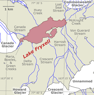
Lake Fryxell, Taylor Valley.
See: Overview maps
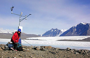
Robin works on the Lake Fryxell meteorology station. 2001. Photo: Thomas Nylen.
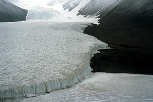
Lake Fryxell at its contact with Canada Glacier. Further upstream, Canada Glacier blocks the Taylor Valley drainage, forming Lake Hoare. 1989. Photo: Sarah Spaulding.
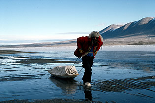
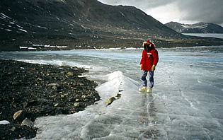
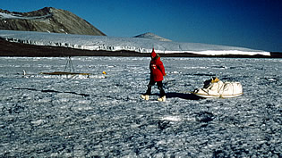
Rich Harnish hauling lake sampling gear along the well-formed moat of Lake Fryxell. 1989. Photo: Sarah Spaulding.
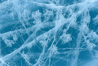
Clear annual moat ice on Lake Fryxell 1988. Photo: Sarah Spaulding.
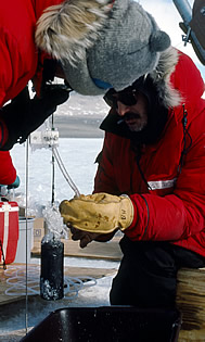
Collecting Lake Fryxell deep water for chemical and biological analysis. 0. Photo: Sarah Spaulding.
Lake Fryxell moat ice, early in the austral summer. Benthic algal mats are most abundant in the photic zone of the ""moat"". 1990. Photo: Sarah Spaulding.
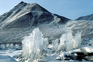
Lake Fryxell pinnacle ice. As lake ice ablates, it forms bizarre shapes late in the austral summer. 1989. Photo: Sarah Spaulding.
Hauling lake sampling gear on Lake Fryxell. 1988. Photo: Sarah Spaulding.
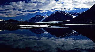
Lake Fryxell reflection. 0. Photo: Michael Gooseff.